

A Pacific Coast Highway road trip is the ultimate California experience, tracing the dramatic cliffs and coastal towns between San Francisco and Los Angeles. Covering roughly 700 km of Highway 1, this iconic route offers sweeping ocean views, towering redwoods, and historic landmarks. Driving this coastal stretch is a highlight of any USA guide itinerary.
Planning Your Pacific Coast Highway Road Trip
To do this drive justice, you need at least five to seven days. While you can physically drive the 700 km in a single long day, doing so means missing the viewpoints, state parks, and coastal towns that make the route famous. If you are building a broader USA Itinerary: 7, 10 and 14 Days, allocate a solid week to the coast to allow for a relaxed pace.
The best time to drive Highway 1 is in September or October. During early autumn, the summer crowds have thinned, and the coastal fog—locally known as “June Gloom” or “Fogust”—has usually cleared, leaving sunny days around 20°C to 25°C (68°F to 77°F). Spring is also beautiful for wildflowers, though rain is more likely. Winter brings migrating gray whales, but also the highest chance of storms and landslides. For more on regional climates, check the Best Time to Visit USA: Weather and Seasons by Region.
Always drive from north to south (San Francisco to Los Angeles). This puts your car on the ocean side of the highway, giving you unobstructed views of the Pacific and making it much easier to pull into the scenic turnouts. If you drive south to north, you will constantly have to cross oncoming traffic to reach the viewpoints.
Logistics, Visas, and Costs
Most international travellers fly into San Francisco International Airport (SFO) and fly out of Los Angeles International Airport (LAX). Renting a car for a one-way trip usually incurs a drop fee, which can add $100 to $300 to your rental cost. A convertible is a popular choice, but an SUV offers better visibility over the guardrails.
Before booking flights, ensure your paperwork is sorted. Review the USA Visa and Entry Requirements to see what you need. Most UK and Australian citizens qualify for the visa waiver programme; read ESTA Explained: Who Needs It and How to Apply for the exact steps to secure your travel authorisation.
California is an expensive destination, and the coastal towns cater to a premium market. Here is a rough daily budget breakdown for two people sharing a car and a room:
| Expense Category | Estimated Daily Cost (USD) |
|---|---|
| Car Rental & Insurance | $60 – $120 |
| Fuel (varies by vehicle) | $20 – $40 |
| Accommodation (Motel to Mid-range) | $150 – $300+ |
| Food & Drink | $80 – $150 |
| State Park Fees & Attractions | $15 – $40 |
Accommodation in Big Sur is notoriously pricey, often starting at $400 to $800 per night. To save money, base yourself in nearby towns like Monterey, Carmel, or Cambria, where standard motels range from $120 to $250. For a broader look at budgeting across the country, see USA Travel Cost: How Much Does a Trip Cost?.
The Classic Route: San Francisco to Los Angeles
Monterey and Carmel-by-the-Sea
Starting south from San Francisco, your first major stop is the Monterey Peninsula. Visit the world-renowned Monterey Bay Aquarium on Cannery Row, then drive the 17-Mile Drive (a toll road costing around $12 per vehicle) through the manicured golf courses of Pebble Beach. Keep an eye out for sea otters playing in the kelp forests offshore.
Just south of the peninsula is Carmel-by-the-Sea, a highly walkable, storybook town known for its Spanish mission and dog-friendly white sand beach. Before leaving the area, spend a few hours hiking the coastal trails at Point Lobos State Natural Reserve, often called the crown jewel of the California State Park system.
Big Sur
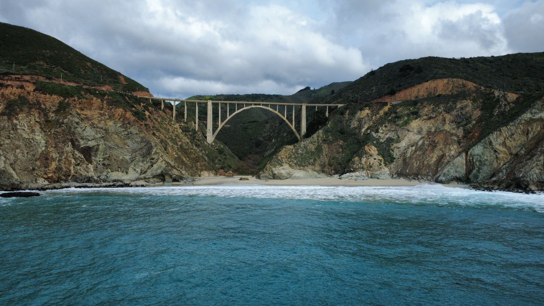
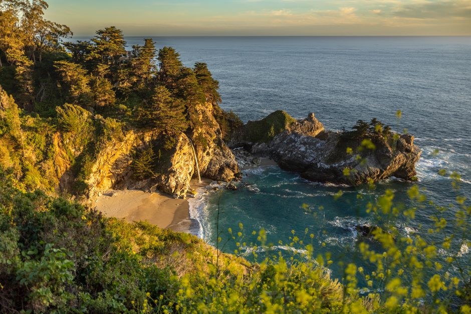
This 145 km stretch of rugged coastline is the undisputed highlight of the drive. The Santa Lucia Mountains plunge directly into the Pacific Ocean, creating a dramatic landscape of sheer cliffs and redwood canyons. You will cross the iconic Bixby Creek Bridge, one of the most photographed bridges in California, and see the 24-metre McWay Falls dropping directly onto the beach at Julia Pfeiffer Burns State Park.
2026 Update: After years of severe landslide closures (including the massive Regent’s Slide), Highway 1 fully reopened through Big Sur in early 2026. You can now drive the entire route uninterrupted again. Stop for lunch at Nepenthe, a famous cliffside restaurant offering panoramic views of the coast, but expect to pay a premium for the location.
San Simeon, Cambria, and Morro Bay
As the cliffs level out, you reach the Central Coast. Stop at the Piedras Blancas Elephant Seal Rookery just north of San Simeon to see thousands of massive seals resting on the sand. Inland, Hearst Castle offers tours of William Randolph Hearst’s opulent 1920s estate. Book your tickets weeks in advance, as walk-ups are rarely available.
Continue south to Cambria, famous for its Moonstone Beach and wooden boardwalk. Further down the coast, Morro Bay is instantly recognisable by Morro Rock, a massive volcanic plug sitting in the harbour. This stretch of the coast is much more affordable than Big Sur and makes an excellent overnight stop.
Santa Barbara and Malibu
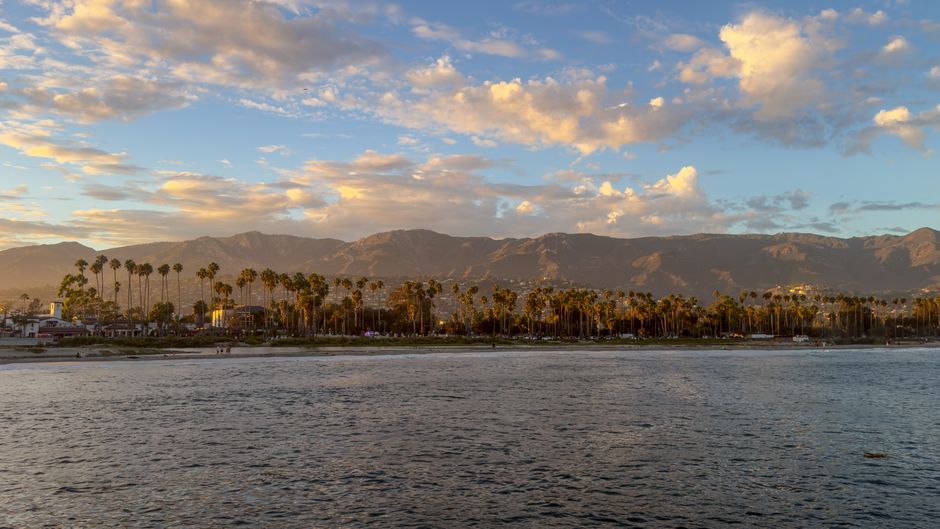
Known as the American Riviera, Santa Barbara features uniform Spanish Colonial Revival architecture, white stucco buildings, and red-tile roofs. Walk down State Street to Stearns Wharf, or visit the Old Mission Santa Barbara. The climate here is noticeably warmer and drier than the northern sections of the drive.
Your final stretch takes you through Malibu, where celebrity homes line the cliffs above Zuma Beach and Surfrider Beach. The road eventually turns into the busy Pacific Coast Highway of Los Angeles, ending in Santa Monica, where you can walk the famous pier.
Where to Stay Along the Route
Choosing where to sleep dictates the pace of your trip. Because driving after dark on Highway 1 means missing the views and navigating dangerous, unlit cliff roads, you should plan your overnight stops carefully. Here are the most practical towns to base yourself in.
Monterey or Carmel
These towns are the perfect staging ground for your drive south. Monterey offers large, family-friendly hotels and chain motels, making it the more budget-friendly option. Carmel is highly upscale, featuring boutique inns and bed-and-breakfasts tucked into residential neighbourhoods. Staying here allows you to wake up early and hit Big Sur before the day-trippers arrive.
Cambria or Morro Bay
After driving through Big Sur, you will want a place to rest. Cambria is a quiet, pine-studded village with a string of comfortable motels lining Moonstone Beach. Morro Bay, just 30 minutes further south, is a working fishing village with slightly cheaper accommodation and excellent seafood restaurants. Both put you in a great position to tour Hearst Castle the following morning.
Santa Barbara
For your final night before hitting the heavy traffic of Los Angeles, Santa Barbara is ideal. The hotels near West Beach and the Funk Zone (a walkable wine-tasting district) put you right in the centre of the action. Accommodation here is expensive, but it offers a quintessential Southern California resort experience.
Insider Tips and Mistakes to Avoid
The biggest mistake travellers make is underestimating the driving time. Highway 1 is a winding, two-lane road with a speed limit that frequently drops to 40 km/h around tight bends. Do not rely on standard GPS time estimates; add at least 30% to your driving time for slow traffic, recreational vehicles, and inevitable photo stops.
Fuel up in Carmel before heading south, or in Cambria if heading north. There are only a couple of petrol stations in Big Sur, and they charge some of the highest prices in the North America guide region. Mobile phone reception also drops out completely through most of Big Sur, so download offline maps before you leave your hotel.
While the route is heavily travelled, the cliffside drops require your full attention. Pull over only in designated turnouts, and never cross the highway on foot on a blind corner to get a better photo. For general advice on staying secure on the road, read Is USA Safe to Visit? Safety Tips for Travellers and our USA Travel Tips: What to Know Before You Go.
What to Combine It With
A coastal drive pairs perfectly with California’s inland scenery. From San Francisco, you can easily detour east to Yosemite National Park before starting your drive south. Read our guide to the Best National Parks in the USA to see how to fit the granite peaks of the Sierra Nevada mountains into your trip.
If you end your trip in Los Angeles, you are right at the terminus of another iconic American drive. The Santa Monica Pier marks the official end of the Mother Road, making it a great jumping-off point for a reverse Route 66 Road Trip heading east into the Mojave Desert.
Plan Your Trip
- Check road conditions: Even though the major 2026 repairs are complete, Highway 1 is always vulnerable to sudden rockfalls or El Niño storm damage. Always check the Caltrans QuickMap app on the morning of your drive.
- Pack layers: The California coast is windy and prone to sudden temperature drops. A sunny 25°C (77°F) day in Los Angeles can easily turn into a foggy 12°C (53°F) afternoon in Big Sur.
- Book ahead: Coastal motels and state park campsites book out up to six months in advance, especially for summer and autumn dates. If you want to stay inside Big Sur, you must secure your accommodation long before you book your flights.
- Bring a parks pass: If you plan to visit multiple state and national parks, check if an annual pass makes financial sense for your itinerary.