


Choosing the best national parks usa has to offer is the cornerstone of planning a trip to the country. From the geothermal basins of Yellowstone to the sheer granite walls of Yosemite, the US National Park System protects some of the most dramatic landscapes on earth. Getting the logistics right—from booking timed entry slots on Recreation.gov to mapping out massive driving distances—is essential for a smooth trip.
With 63 designated national parks across the country, narrowing down your route requires careful planning. If you are starting from scratch, our comprehensive USA guide and broader North America guide provide excellent starting points for regional overviews.
Essential Logistics for the Best National Parks USA
Visiting these protected areas requires more than just turning up at the gate. As of 2026, many of the most popular parks use timed-entry reservation systems during peak months (usually May to October) to manage vehicle traffic. You must book these slots months in advance on Recreation.gov.
If you plan to visit three or more parks, buy the America the Beautiful Pass. It costs $80 USD and covers entrance fees for one vehicle at all federal recreation sites for 12 months. Since individual park entry typically costs $30 to $35 USD per vehicle, the pass pays for itself very quickly. For a detailed breakdown of daily expenses, review our guide on USA Travel Cost: How Much Does a Trip Cost?.
| National Park | Peak Season Timed Entry Required (2026) | Nearest Major Airport |
|---|---|---|
| Yellowstone | No | Bozeman (BZN) / Jackson Hole (JAC) |
| Yosemite | Yes (Summer/Weekends) | San Francisco (SFO) / Fresno (FAT) |
| Glacier | Yes (Going-to-the-Sun Road) | Glacier Park Int. (FCA) |
| Arches | Yes (April – October) | Salt Lake City (SLC) / Moab (CNY) |
| Grand Canyon | No | Phoenix (PHX) / Las Vegas (LAS) |
Yellowstone National Park, Wyoming
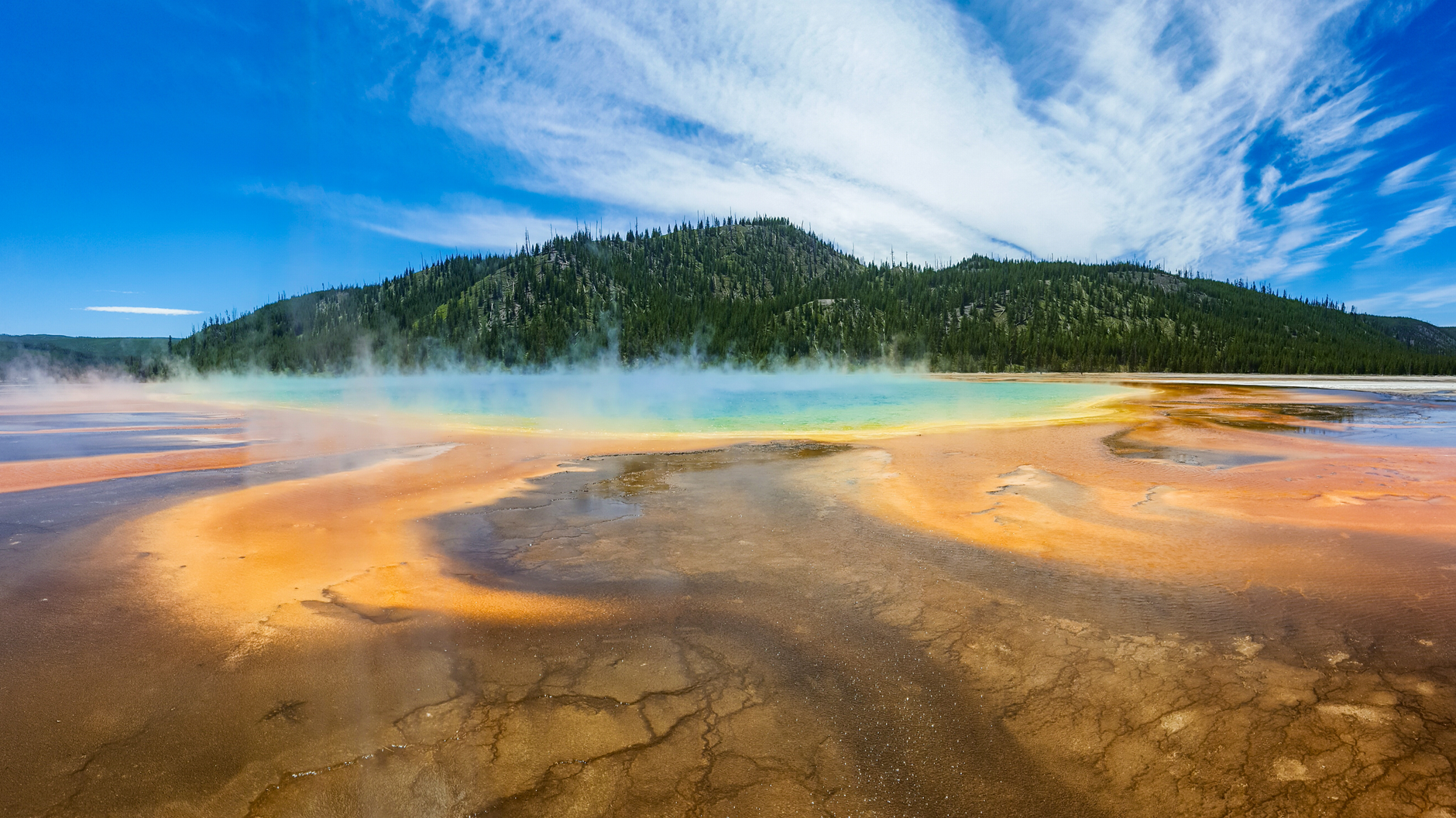
Yellowstone is the world’s first national park and sits atop a massive dormant volcano. It is famous for its geothermal features, containing half of the world’s active geysers. Old Faithful erupts roughly every 90 minutes, while the Grand Prismatic Spring offers vivid rings of orange, yellow, and blue thermophile bacteria.
Wildlife viewing is the other major draw. Lamar Valley, often called America’s Serengeti, is the best place to spot bison herds, elk, and grey wolves. You need at least three to four full days to drive the Grand Loop Road. Distances are vast, and traffic jams caused by bison crossing the road (bison jams) are common.
Summer daytime temperatures average 20°C to 25°C (68°F to 77°F), but nights drop near freezing. Most park roads close to regular vehicles from early November to late April due to heavy snow, accessible only by guided snowmobile or snowcoach.
Yosemite National Park, California
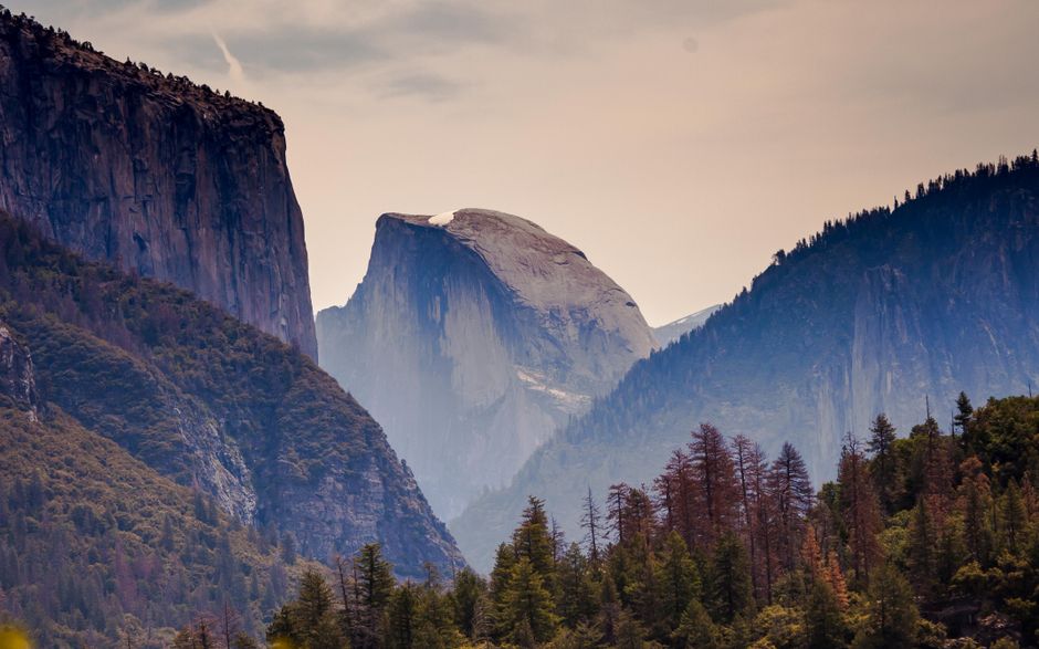
Located in the Sierra Nevada mountains, Yosemite is defined by its towering granite monoliths and dramatic waterfalls. Yosemite Valley is the main hub, home to the sheer 900-metre face of El Capitan and the iconic shape of Half Dome. Hiking the Mist Trail to Vernal and Nevada Falls is a steep but highly rewarding half-day route.
Because Yosemite is just a 300 km drive from San Francisco, it gets exceptionally busy. Booking accommodation in the valley, such as Curry Village or the Yosemite Valley Lodge, requires reserving exactly 366 days in advance. Many travellers combine this park with a coastal drive; see our California Road Trip: Pacific Coast Highway itinerary for route ideas.
The high-elevation Tioga Pass, which connects Yosemite to the Eastern Sierra, only opens from late May or June until November. If you visit in winter, stick to Yosemite Valley, which remains open year-round and looks spectacular under snow.
Grand Canyon National Park, Arizona
The Grand Canyon is 445 km long, up to 29 km wide, and over 1.6 km deep. The South Rim is the most accessible and popular section, open year-round with extensive shuttle systems and viewpoints along Hermit Road and Desert View Drive. The North Rim is higher, cooler, and much quieter, but closes entirely from mid-October to mid-May due to snow.
To truly grasp the scale of the canyon, you need to hike below the rim. The Bright Angel Trail and South Kaibab Trail offer steep descents. Summer temperatures at the canyon floor frequently exceed 40°C (104°F), so hiking down and back up in a single day during summer is highly dangerous and strongly advised against by park rangers.
The South Rim is a four-hour drive from Phoenix or Las Vegas. It makes a perfect detour if you are driving historic highways; read our Route 66 Road Trip guide for the best stops between Chicago and Los Angeles.
Zion and Arches National Parks, Utah
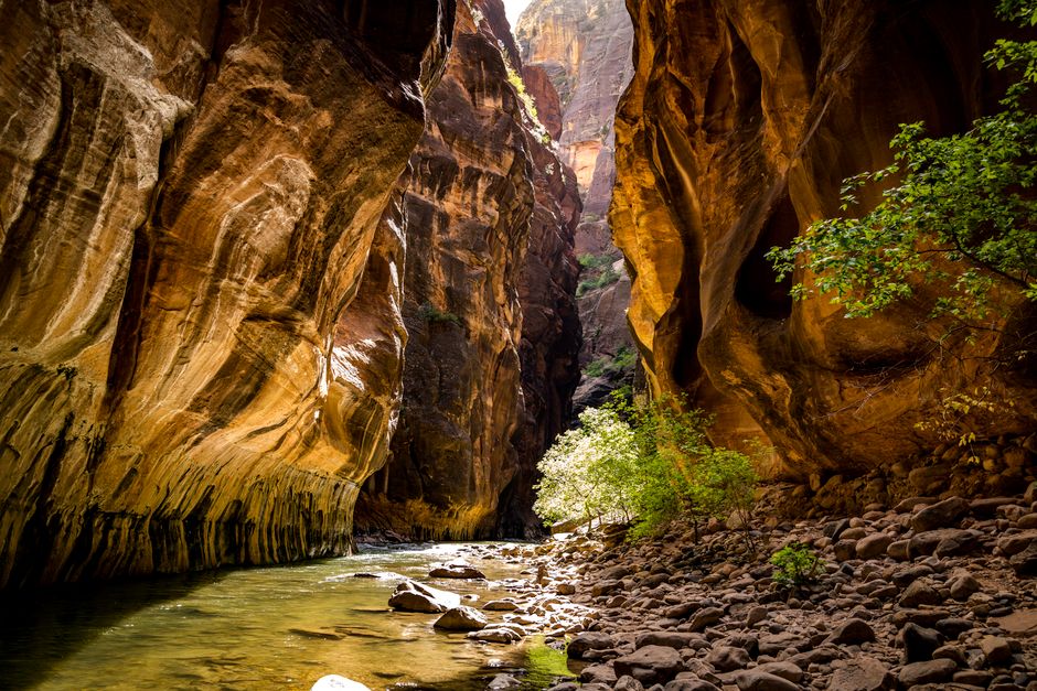
Utah boasts five national parks, often called the Mighty 5, but Zion and Arches stand out. Zion National Park features a deep, narrow canyon cut by the Virgin River. Instead of driving along the rim, you drive (or take the mandatory park shuttle) along the canyon floor, looking up at massive Navajo Sandstone cliffs.
Zion’s two most famous hikes require preparation. The Narrows involves wading directly upstream in the river, requiring proper water shoes and a walking stick. Angels Landing is a steep, exposed ridge hike with chain handholds; you must win a lottery permit on Recreation.gov to hike the final section.
Arches National Park, located 550 km east of Zion near Moab, contains over 2,000 natural stone arches. Delicate Arch is the most famous, requiring a 4.8 km round-trip hike over slickrock. Arches strictly enforces a timed entry system from spring through autumn to prevent severe gridlock on its single scenic drive.
Rocky Mountain National Park, Colorado
Located just a 90-minute drive from Denver, Rocky Mountain National Park offers some of the highest paved roads in the country. Trail Ridge Road crosses the Continental Divide, reaching an elevation of 3,713 metres. Up here, the ecosystem changes to alpine tundra, where trees cannot grow and you might spot bighorn sheep and marmots.
Because of its proximity to a major city, timed entry permits are strictly enforced from late May through October. The park divides these permits into two tiers: one that includes the highly popular Bear Lake Road corridor, and one for the rest of the park. If you want to hike to Emerald Lake or Dream Lake, you must secure the Bear Lake permit.
Altitude sickness is a genuine risk here. Spend a day or two acclimatising in Denver (1,600 metres) or Estes Park (2,290 metres) before attempting strenuous hikes. Drink plenty of water and turn back if you experience severe headaches or dizziness.
Glacier National Park, Montana
Bordering Canada, Glacier National Park offers rugged alpine scenery, pristine lakes, and dense forests. The centrepiece is the Going-to-the-Sun Road, an 80 km engineering marvel that crosses the Continental Divide at Logan Pass. Due to heavy snowfall, this road is fully open for a very short window, typically late June to mid-September.
Glacier is prime grizzly bear habitat. Hiking in groups, making noise on the trail, and carrying bear spray (and knowing how to use it) are mandatory safety practices here. You cannot fly with bear spray, so rent or buy it in nearby towns like Whitefish or Kalispell.
Death Valley National Park, California and Nevada
Death Valley is a park of extremes. It holds the record for the hottest air temperature ever recorded on Earth and is the driest and lowest place in North America. Badwater Basin sits 86 metres below sea level, featuring vast polygonal salt flats that stretch to the horizon.
Visiting in summer is dangerous and offers a miserable experience, with daytime temperatures routinely exceeding 45°C (113°F). The best time to visit is between November and March, when daytime temperatures hover around a comfortable 15°C to 20°C (59°F to 68°F).
Key sights include Zabriskie Point at sunrise, the rolling Mesquite Flat Sand Dunes, and the colourful mineral deposits of Artists Palette. Death Valley is a two-hour drive from Las Vegas, making it an easy winter addition to a desert itinerary. Ensure your vehicle has a full tank of petrol and carry at least four litres of water per person, per day.
Acadia National Park, Maine
While the western US dominates the national park conversation, Acadia National Park on the rocky coast of Maine is the crown jewel of the east. Located primarily on Mount Desert Island, it offers a mix of granite peaks, ocean shorelines, and dense woodlands.
Driving the 43 km Park Loop Road provides access to Sand Beach, Thunder Hole, and Jordan Pond, where eating popovers at the Jordan Pond House is a long-standing tradition. Acadia is also famous for Cadillac Mountain; between October and March, it is the first place in the US to see the sunrise. You must book a vehicle reservation to drive up Cadillac Mountain during the summer and autumn foliage seasons.
Planning Your Park Itinerary and Weather
Stringing these parks together requires understanding the sheer scale of the USA. You cannot drive from Yosemite to Yellowstone to the Grand Canyon in a single week. To structure a realistic trip, check our USA Itinerary: 7, 10 and 14 Days.
Weather varies drastically depending on elevation and region. Death Valley can reach 50°C (122°F) in July, while Yellowstone can see snow in September. Knowing what to pack is critical. Review our guide on the Best Time to Visit USA: Weather and Seasons by Region to align your park choices with the best possible conditions.
Essential Admin and Safety
Before booking flights or park lodges, ensure your entry paperwork is sorted. International visitors must understand the USA Visa and Entry Requirements. If you are travelling from a Visa Waiver Program country (like the UK or Australia), you must secure your electronic authorization beforehand. Read our ESTA Explained: Who Needs It and How to Apply guide for the exact steps.
Safety in national parks relies on personal responsibility. Wildlife encounters, extreme heat, and sudden weather changes pose real risks. Keep a minimum of 90 metres from bears and wolves, and 23 metres from bison and elk. For broader advice on staying secure during your trip, read Is USA Safe to Visit? Safety Tips for Travellers.
Finally, brush up on local customs, tipping culture, and driving laws. Our USA Travel Tips: What to Know Before You Go covers the day-to-day practicalities of navigating the country.
Final Tips for Your Park Trip
- Download offline maps: Mobile phone reception is non-existent in most national parks. Download Google Maps for offline use and install the official NPS (National Park Service) app to save park maps and trail guides to your device.
- Pack layers: Desert parks like Arches and the Grand Canyon experience massive temperature swings. A 35°C (95°F) afternoon can quickly become a 10°C (50°F) evening.
- Start early: To avoid the worst crowds and the midday heat, aim to be at the trailhead or popular viewpoints by 7:00 AM.
- Leave no trace: Pack out all your rubbish, stay on marked trails to protect fragile ecosystems, and never feed wild animals.