

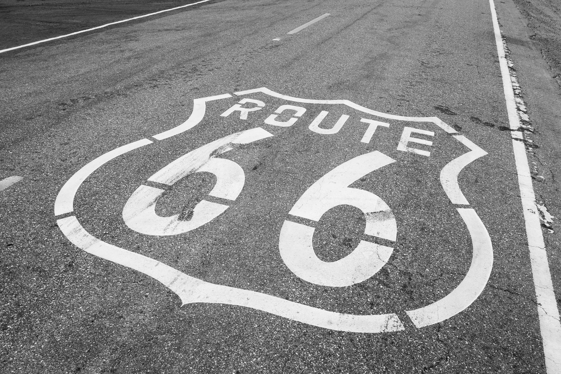
A Route 66 road trip is the classic American cross-country drive, stretching nearly 4,000 km from Chicago, Illinois, down to the Santa Monica Pier in California. It takes you through eight states, bypassing modern interstates in favour of two-lane highways, historic neon signs, and vast desert landscapes. Driving the Mother Road requires careful planning, as the original route was officially decommissioned in 1985.
Today, navigating the route means piecing together historic alignments, frontage roads, and sections of modern interstates like I-40 and I-55. Before setting off, familiarise yourself with our comprehensive guide to the USA and broader North America travel resources to understand the sheer scale of the country.
Planning Your Route 66 Road Trip
The traditional way to drive Route 66 is east to west, following the historical migration path from Chicago to Los Angeles. You will cross three time zones and experience a dramatic shift in scenery, from the cornfields of the Midwest to the arid Mojave Desert.
Because the road is no longer a single, continuous highway, you cannot rely entirely on standard GPS. Standard mapping apps will constantly try to reroute you onto the faster interstates. You must use physical guidebooks, like the EZ66 Guide, or dedicated navigation apps designed specifically for the historic alignments.
If you cannot commit to the full cross-country journey, consider tackling a specific state or region. You can integrate a shorter section into a standard 7, 10, or 14-day USA itinerary.
How Much Time Do You Need?
To drive the entire route from Chicago to Santa Monica, you need an absolute minimum of 14 days. This requires driving between 250 km and 350 km daily, which leaves just enough time for quick stops at diners and roadside attractions. For a more relaxed pace, allowing you to explore the towns and detour to nearby national parks, 21 days is ideal.
Here is a practical 14-day driving schedule to keep you on track:
| Day | Start | End | Approx. Distance |
|---|---|---|---|
| 1 | Chicago, IL | Springfield, IL | 325 km |
| 2 | Springfield, IL | St. Louis, MO | 160 km |
| 3 | St. Louis, MO | Springfield, MO | 345 km |
| 4 | Springfield, MO | Tulsa, OK | 290 km |
| 5 | Tulsa, OK | Oklahoma City, OK | 170 km |
| 6 | Oklahoma City, OK | Amarillo, TX | 420 km |
| 7 | Amarillo, TX | Santa Fe, NM | 450 km |
| 8 | Santa Fe, NM | Gallup, NM | 320 km |
| 9 | Gallup, NM | Holbrook, AZ | 155 km |
| 10 | Holbrook, AZ | Flagstaff, AZ | 145 km |
| 11 | Flagstaff, AZ | Kingman, AZ | 235 km |
| 12 | Kingman, AZ | Needles, CA | 100 km |
| 13 | Needles, CA | Barstow, CA | 230 km |
| 14 | Barstow, CA | Santa Monica, CA | 210 km |
Best Time for a Route 66 Road Trip
The ideal times to drive Route 66 are spring (May to early June) and autumn (September to October). During these months, the weather is generally mild across the Midwest, and the desert sections in Arizona and California are manageable. For more regional climate details, check our guide on the best time to visit the USA.
Summer (July and August) is the peak tourist season, but it brings extreme heat. Temperatures in the Mojave Desert regularly exceed 40°C (104°F), which puts immense strain on your vehicle and makes outdoor stops uncomfortable. Conversely, winter brings heavy snow and ice to Illinois, Missouri, and the higher elevations of New Mexico and Arizona, making driving hazardous.
Costs and Budgeting
A cross-country road trip requires a solid budget. Your primary expenses will be car rental, fuel, accommodation, and food. Expect to pay between $80 and $150 per night for standard motels, though historic, restored properties often charge a premium. Daily food costs typically range from $40 to $70 per person if you eat at classic diners and local restaurants.
Car rental is a significant expense, particularly because of the one-way drop fee. Rental companies often charge an additional $500 to $1,000 for picking up a car in Chicago and returning it in Los Angeles. For a detailed breakdown of daily expenses, read our guide on USA travel costs.
Visas, Safety and Practicalities
International travellers must ensure their paperwork is in order before booking flights. Most visitors from the UK and Australia will need an Electronic System for Travel Authorization. Read our guide on applying for an ESTA to ensure you are eligible, and review the general USA visa and entry requirements.
Driving across the USA is generally safe, but Route 66 takes you through very remote areas with limited mobile phone reception. Always carry extra water, a physical map, and a basic first aid kit. Review our safety tips for travellers and our essential USA travel tips to prepare for long-distance driving and local traffic laws.
Essential Stops by State
Illinois to Missouri
Your journey begins at the official start sign on Adams Street in downtown Chicago. Before leaving the city, grab breakfast at Lou Mitchell’s, a diner that has been serving Route 66 travellers since 1923. As you drive south, stop in Pontiac to visit the Route 66 Association Hall of Fame, and grab a corn dog at the Cozy Dog Drive In in Springfield.
Crossing the Mississippi River brings you into Missouri and the shadow of the Gateway Arch in St. Louis. Further west, you can explore the Meramec Caverns, a massive limestone cave system heavily advertised on barns along the highway since the 1930s.
Kansas to Oklahoma
Route 66 only clips the southeastern corner of Kansas for about 21 km, but it is worth the detour. Stop in Galena to see the restored Kan-O-Tex service station, which features the vintage tow truck that inspired the character Mater in the animated film Cars.
Oklahoma boasts the longest drivable stretch of the original route. Highlights include the Blue Whale of Catoosa, a quirky waterfront structure built in the 1970s, and Pops 66 in Arcadia, a modern diner and petrol station featuring a giant neon soda bottle and hundreds of soda flavours.
Texas to New Mexico
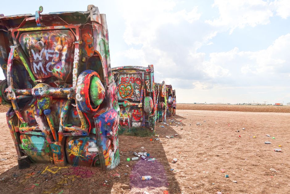
The Texas panhandle is flat, straight, and iconic. The must-see stop is Cadillac Ranch in Amarillo, an art installation featuring ten vintage Cadillacs buried nose-down in a field. Bring a can of spray paint to leave your mark. Shortly after, you will reach the MidPoint Cafe in Adrian, which marks the exact halfway point between Chicago and Los Angeles.
Entering New Mexico, the landscape shifts to red mesas and desert scrub. Take the pre-1937 alignment loop up to Santa Fe to explore its historic plaza and adobe architecture. In Tucumcari, the neon signs of the Blue Swallow Motel offer one of the most photographed night scenes on the entire route.
Arizona to California
Arizona is packed with natural wonders and classic Americana. Drive through the Petrified Forest National Park, the only national park that contains a section of the historic route. Spend a night in Holbrook at the Wigwam Motel, where you sleep in concrete teepees. Further west, navigate the hairpin turns of the Black Mountains to reach Oatman, a former mining town where wild burros roam the streets.
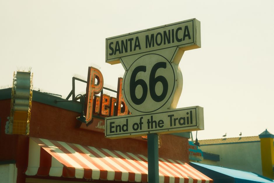
The final stretch through California crosses the unforgiving Mojave Desert. Stop at Roy’s Motel and Café in Amboy for a photo with its towering mid-century neon sign. The journey finally concludes at the Santa Monica Pier, where the “End of the Trail” sign overlooks the Pacific Ocean.
What to Combine With Your Drive
Route 66 passes incredibly close to some of the country’s most spectacular landscapes. In Arizona, a detour north from Flagstaff or Williams to the Grand Canyon is practically mandatory. You can easily spend two or three days exploring the rim. For more ideas, check our list of the best national parks in the USA.
Once you reach the end of the route in Santa Monica, you do not have to stop driving. If you have an extra week, turn north and drive up the coast to San Francisco. Read our guide to planning a Pacific Coast Highway road trip for the best coastal stops.
Mistakes to Avoid
The biggest mistake travellers make is relying solely on Google Maps or Apple Maps. These apps are programmed to find the fastest route, which means they will constantly pull you off the historic two-lane roads and onto the interstate. You must use waypoints or a dedicated Route 66 navigation app to stay on the correct path.
Another common error is underestimating the driving distances. Looking at a map of the USA can be deceptive; driving across Texas or Arizona takes much longer than you might expect. Do not plan to drive more than 350 km in a single day if you actually want to stop and see the attractions.
Finally, do not leave your accommodation to chance if you want to stay in the famous historic motels. Properties like the Blue Swallow in Tucumcari or the El Vado in Albuquerque have limited rooms and often book out six months in advance during the peak spring and autumn seasons.
Plan Your Trip
Start by securing your rental car well in advance to lock in the best rate and absorb the one-way drop fee. Purchase a physical copy of the EZ66 Guide for Travelers, download offline maps for the desert sections, and pack layers of clothing to handle the drastic temperature changes between the Midwest and the Mojave.